Showing posts with label Quebec. Show all posts

Friday, October 30, 2026

Mont Écho, Quebec 10/29/2026

During a short trip to Quebec this week, we spent a day hiking Mont Écho in Sutton. The trails on Mont Echo are part of the Les Sentiers de L'Estrie network, and we started our hike from the Chemin de la Falaise Trailhead. At the trailhead, we paid the $9 day use fee and started down the trail. After traversing lowlands for a bit, the trail began to gradually climb the northwest slope of the mountain, passing a narrow and deep gorge along the way. The trail was extremely well constructed with sturdy bridges, switchbacks, and excellent drainage the entire way.

Bridge near the start of the trail
A small gorge next to the trail

Upon reaching a trail junction in the saddle between Mont Écho and Mont Singer, we turned left towards Mount Singer to do a short out-and-back section of trail to Passe du Diable (Devil's Pass) and L'Etang des Mallards (Mallard Pond). Devil's Pass is a rugged gap in the mountains with steep rocky sides, and lots of fallen boulders. Just beyond the Pass, Mallard Pond is a tiny pond with steep slopes and cliffs surrounding it on almost every side. These two spots were very rugged and beautiful, and they were well worth the side trip.
Devil's Pass
Mallard Pond
A large boulder along the trail
After the short detour, we continued up Mont Écho. The trail remained mostly at easy grades with a few short moderate sections. It wound its way up the mountain along a rather circuitous route, and we were treated to glimpses of the tall cliff face above us, to which the trail would eventually lead. We turned right at a trail junction near the summit, and soon reached the top of the mountain. Here there was a clearing with the remains of an old chairlift from the ski area which used to operate on the mountain, along with a view towards Mont Brome. Just beyond the clearing were the remains of a second chairlift, which we passed on our way to the end of the trail at an impressive cliff-top viewpoint. This viewpoint offered excellent views to the south, east, and north. Besides many peaks in Quebec which were visible, a large portion of the northern Green Mountains in Vermont could also be seen.
The summit
Remains of one of the two old ski lifts near the summit
The clifftop viewpoint
View east
View south towards Vermont
We enjoyed the beautiful view as we ate lunch, and then headed back down the way we came up. After returning to the bottom of the mountain, we continued past the trailhead a short distance to beautiful waterfalls and a deep gorge with 3 observation decks. Unsurprisingly, Mont Écho turned out to be another excellent Quebec hike, and I hope to come back to explore more of the mountains in the Sutton region!

The first waterfall along the short section of trail to the west of the trailhead

Cascades in the gorge at the end of the trail
AllTrails Activity

Saturday, September 26, 2026

Chartierville, Quebec Camping & Hiking 9/22–9/25/2026

This year, our annual Quebec camping trip brought us to the small village of Chartierville.

 
On Tuesday, after getting groceries in La Patrie, we went for our first hike of the trip on the Sentiers Frontaliers network of trails. This short hike on Sentier principal vers le Mont Mégantic brought us to a massive old white pine. Along the way, we passed through a sugarbush and had to ford a small river. After reaching the tree, we had lunch beside the river, before heading back.
Starting our hike to the huge pine tree
The river that we forded
The massive white pine
We then drove to Camping du Ruisseau in Chartierville. This municipal campground has 8 RV sites and 6 tent sites, and when we arrived, none of them were occupied! We chose Site 3, the most secluded and private site tucked into the dense forest. After setting up camp, we played the municipal miniature golf course, located next to the campground, and walked around the village. We found it to be a picturesque Quebecoise village, and the near peak foliage made the mountain scenery especially stunning.
Sign for the campground
Frosty Wednesday morning
We awoke Wednesday morning to a heavy frost blanketing the landscape. Sierra opted to spend the day at the campsite, while Sampson and I went for a hike. We returned to the extensive Sentiers Frontaliers trail system to hike to two peaks on the Canada/United States border. We started our hike on Le sentier des 40 colons which brought us through a basin between the mountains. The trail was well built and marked, but seemed lightly trafficked and had a wild and remote feel to it—I loved it! After a short stretch on Le sentier du Mont Trumbell, we reached Sentier principal and a lean-to for backpackers.
Staionnment Mario Dostie
View ahead towards Mont Trumbell
Lean-to near the base of  Mont Trumbell
Past the lean-to, we started the steep ascent up Mont Trumbell (Snag Pond Peak). We reached the border swath shortly before making it to the summit. There were some good views near the summit from the swath. We then descended into the saddle between Mont Trumbell and Mont D'Urban, before climbing the latter. We reached the forest summit of Mont D'Urban on the swath, and then turned around, eating lunch at a good viewpoint towards Mont Trumbell a little while later.
View towards Mont Salmon from the border swath on Mont Trumbell
Border marker
Heading towards Mont D'Urban
After ascending much of the way back up Mont Trumbell, we turned right onto Le sentier du Mont Trumbell and made our way back to where we parked. The total hike distance was 10.7 miles and we didn't see anyone else the entire way.
View back towards Mont Trumbell from Mont D'Urban
View towards Chartierville from Mont D'Urban
At the summit of Mont D'Urban
After a second night of having the campground completely to ourselves, we awoke to another cold, frosty morning on Thursday. After breakfast in camp, we headed back to the Sentiers Frontaliers for another hike.
 
Starting again from Staionnment Mario Dostie, we began hiking on Sentier principal. At the first trail junction, Sampson and I continued up Mont Salmon, while Sierra turned onto Le sentier des 40 colons to head directly to Mont Trumbell (Snag Pond Peak). The ascent up Mont Salmon was gradual at first and then became moderately steep. After reaching the border swath, the trail followed the swath along the summit ridge of the mountain. Because the true summit is located in New Hampshire, we only went as high as the trail did.
On the border swath on Mont Salmon
Hiking along the swath
One of many hunting shacks along the border
After the highpoint on Mont Salmon, we descended to the backpacking shelter, before climbing Mont Trumbell for the second day in a row. On the climb, we met up with Sierra, shortly before reaching the border swath again. We also made a short detour off of the trail to the true summit of the mountain. We ate lunch at the viewpoint towards Mont Mégantic, enjoying the peak foliage, before heading back down Le sentier du Mont Trumbell and Le sentier des 40 colons back to the car. Yet again, we had the trails completely to ourselves!
At the summit of Mont Trumbell
Summit canister on Mont Trumbell (Snag Pond Peak in the US)
View of the Mégantic Massif from Mont Trumbell
After another, slightly warmer, night at the still empty campground, we packed up on Friday morning and headed south into New Hampshire. After a slightly delayed border crossing (One of the customs officers was late for work!), we went for a short hike at Garfield Falls on the East Branch of the Dead Diamond River. The waterfall was a beautiful spot to climb around and enjoy the scenery.
Viewpoint on the highway south of Chartierville
Garfield Falls
Garfield Falls
Further along, we went for another short hike up The Roost in Umbagog National Wildlife Refuge. This short hike provided excellent cliff-top views of the Magalloway River and to the Mahoosuc Mountains. After the hike, we ate lunch in Errol before driving back to Maine. We had an excellent trip, and we especially enjoyed the solitude in both the campground and on the Sentiers Frontaliers!
Start of the trail up The Roost
View from The Roost
The Mahoosuc Range

Friday, September 29, 2023

Yamaska National Park, Quebec 9/25-9/28/2023

We spent 3 nights this week, camping in Yamaska National Park, just outside of Granby, Quebec. This national park surrounds Réservoir Choinère and has a variety of hiking trails, campgrounds, and bicycle paths.
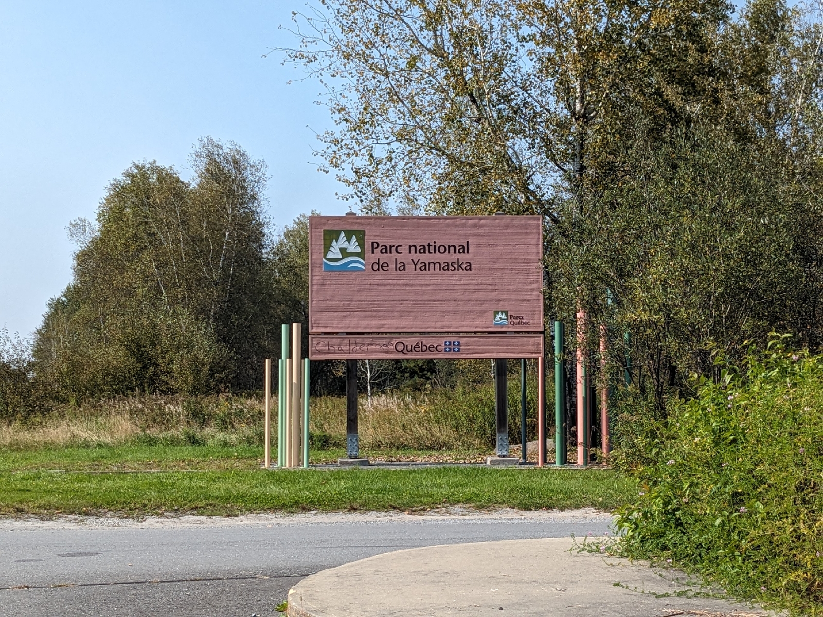
 
The park entrance sign
After driving to the park on Monday, we arrived around 1:00, and went for a short hike on Sentier La Rivière.
 
The trailhead for Sentier La Rivière
This is an easy 2.5 km trail which winds through open forest, alternating between areas of softwood and hardwood.
 
Sentier La Rivière
At the far end of the trail are a couple of picnic tables looking out over the Rivière Yamaska Nord.
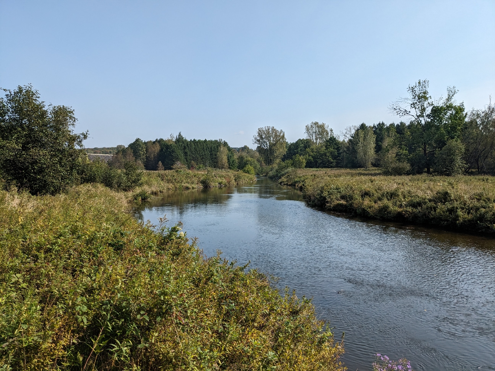
 
Rivière Yamaska Nord
After returning from our short hike, we headed to our campsite to set up camp.
 
Our campsite, number 146
The campground is divided up into 7 different sectors. We were in Secteur Les Roselins. This is the northernmost part of the campground, and contains walk-in tent sites. From your car, wheelbarrows are available to help you carry your stuff to your site. We had an excellent site right on the water.
 
Réservoir Choinère from our campsite
It was also a very private site with no immediate neighboring sites. This part of the campground was almost deserted, and there were only a couple more campers in the entire sector.

We set up camp, and had a dinner of hot dogs and mashed potatoes over the fire. This was our first time trying BBQ hot dogs, which I suppose is a Canadian thing. They had an interesting flavor, almost like the flavoring from BBQ chips had been added. We both agreed that they were pretty good.

On Tuesday, we started out on a longer hike through the park. We started on Sentier La Forestière, before continuing on Sentier La Digue and Sentier La Pinède.
 
Sentier La Forestière
These are all relatively easy trails which pass through the varied forests of the park.
 
Sentier La Digue
The forests range from dark spruce forest, to open maple forest, and were all very interesting.
 
Sentier La Pinède
We had lunch at one of the picnic areas near the far end of our hike, and then headed back to the campground via the bike path which circumnavigates the park.

Wednesday's goal was to ride La Grand-Tour. This 19 km long stone dust bike path encircles Réservoir Choinière.
 
La Grand-Tour
It's a very well constructed path with lots of rest stops and viewpoints along the way. We greatly enjoyed our loop around the lake, and found a perfect picnic area on the Rivière Yamaska Nord to cook some ramen for lunch.
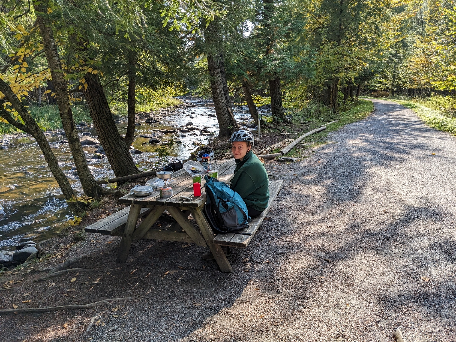
 
Our lunch spot on the Rivière Yamaska Nord
The northern part of the loop is more wooded and hilly, while the southern portion hugs the lakeshore with fewer hills.

On the last day of our trip, we packed up camp and started heading east. We stopped in Scotstown at Parc Régional du Marécage-des-Scots.
 
Parc Régional du Marécage-des-Scots welcome sign
The Rivière au Saumon and Ruisseau McLeod flow through the park, and a bike path travels through the center of the park by both waterways.
 
The bike path through Parc Régional du Marécage-des-Scots
We did an out and back ride along the length of this path. As was the case with the previous day's ride, the bike path was stone dust with excellent signage, and lots of stops along the way. However, there were very few people on this path and it wound its way through much denser forest than we found in Yamaska National Park. It was a beautiful ride with lots of great foliage, especially along the stream.
 
Ruisseau McLeod
After this enjoyable ride, we finally headed back across the border to home, after a quick poutine stop in Woburn, of course!