Showing posts with label New Hampshire. Show all posts

Saturday, September 26, 2026

Chartierville, Quebec Camping & Hiking 9/22–9/25/2026

This year, our annual Quebec camping trip brought us to the small village of Chartierville.

 
On Tuesday, after getting groceries in La Patrie, we went for our first hike of the trip on the Sentiers Frontaliers network of trails. This short hike on Sentier principal vers le Mont Mégantic brought us to a massive old white pine. Along the way, we passed through a sugarbush and had to ford a small river. After reaching the tree, we had lunch beside the river, before heading back.
Starting our hike to the huge pine tree
The river that we forded
The massive white pine
We then drove to Camping du Ruisseau in Chartierville. This municipal campground has 8 RV sites and 6 tent sites, and when we arrived, none of them were occupied! We chose Site 3, the most secluded and private site tucked into the dense forest. After setting up camp, we played the municipal miniature golf course, located next to the campground, and walked around the village. We found it to be a picturesque Quebecoise village, and the near peak foliage made the mountain scenery especially stunning.
Sign for the campground
Frosty Wednesday morning
We awoke Wednesday morning to a heavy frost blanketing the landscape. Sierra opted to spend the day at the campsite, while Sampson and I went for a hike. We returned to the extensive Sentiers Frontaliers trail system to hike to two peaks on the Canada/United States border. We started our hike on Le sentier des 40 colons which brought us through a basin between the mountains. The trail was well built and marked, but seemed lightly trafficked and had a wild and remote feel to it—I loved it! After a short stretch on Le sentier du Mont Trumbell, we reached Sentier principal and a lean-to for backpackers.
Staionnment Mario Dostie
View ahead towards Mont Trumbell
Lean-to near the base of  Mont Trumbell
Past the lean-to, we started the steep ascent up Mont Trumbell (Snag Pond Peak). We reached the border swath shortly before making it to the summit. There were some good views near the summit from the swath. We then descended into the saddle between Mont Trumbell and Mont D'Urban, before climbing the latter. We reached the forest summit of Mont D'Urban on the swath, and then turned around, eating lunch at a good viewpoint towards Mont Trumbell a little while later.
View towards Mont Salmon from the border swath on Mont Trumbell
Border marker
Heading towards Mont D'Urban
After ascending much of the way back up Mont Trumbell, we turned right onto Le sentier du Mont Trumbell and made our way back to where we parked. The total hike distance was 10.7 miles and we didn't see anyone else the entire way.
View back towards Mont Trumbell from Mont D'Urban
View towards Chartierville from Mont D'Urban
At the summit of Mont D'Urban
After a second night of having the campground completely to ourselves, we awoke to another cold, frosty morning on Thursday. After breakfast in camp, we headed back to the Sentiers Frontaliers for another hike.
 
Starting again from Staionnment Mario Dostie, we began hiking on Sentier principal. At the first trail junction, Sampson and I continued up Mont Salmon, while Sierra turned onto Le sentier des 40 colons to head directly to Mont Trumbell (Snag Pond Peak). The ascent up Mont Salmon was gradual at first and then became moderately steep. After reaching the border swath, the trail followed the swath along the summit ridge of the mountain. Because the true summit is located in New Hampshire, we only went as high as the trail did.
On the border swath on Mont Salmon
Hiking along the swath
One of many hunting shacks along the border
After the highpoint on Mont Salmon, we descended to the backpacking shelter, before climbing Mont Trumbell for the second day in a row. On the climb, we met up with Sierra, shortly before reaching the border swath again. We also made a short detour off of the trail to the true summit of the mountain. We ate lunch at the viewpoint towards Mont Mégantic, enjoying the peak foliage, before heading back down Le sentier du Mont Trumbell and Le sentier des 40 colons back to the car. Yet again, we had the trails completely to ourselves!
At the summit of Mont Trumbell
Summit canister on Mont Trumbell (Snag Pond Peak in the US)
View of the Mégantic Massif from Mont Trumbell
After another, slightly warmer, night at the still empty campground, we packed up on Friday morning and headed south into New Hampshire. After a slightly delayed border crossing (One of the customs officers was late for work!), we went for a short hike at Garfield Falls on the East Branch of the Dead Diamond River. The waterfall was a beautiful spot to climb around and enjoy the scenery.
Viewpoint on the highway south of Chartierville
Garfield Falls
Garfield Falls
Further along, we went for another short hike up The Roost in Umbagog National Wildlife Refuge. This short hike provided excellent cliff-top views of the Magalloway River and to the Mahoosuc Mountains. After the hike, we ate lunch in Errol before driving back to Maine. We had an excellent trip, and we especially enjoyed the solitude in both the campground and on the Sentiers Frontaliers!
Start of the trail up The Roost
View from The Roost
The Mahoosuc Range

Sunday, June 14, 2026

West Royce Mountain, NH 6/13/2026

It had been a couple years since I had hiked in the White Mountains, so yesterday we headed to Evans Notch in the White Mountain National Forest to hike West Royce Mountain. Although I've been up East Royce multiple times, I had never been up the taller West Royce. Even though our hike started and ended in Maine, the summit and much of the ascent were in New Hampshire.

Start of the Highwater Trail
Crossing the Wild River at the start of the trail
After leaving a car at the Laughing Lion Trailhead for our descent, we parked at the Highwater Trailhead, near the Wild River. Our hike started on the Highwater Trail along the north bank of the river. This trail was unexpectedly enjoyable, with impressively large white pines along the trail for quite a way. We following the trail until reaching the site of the former Forest Road 52 bridge at 3.2 miles. Here, we forded the river to the south bank.
An old mile marker along the Highwater Trail
Fording the Wild River
We then followed the Wild River Road (closed to vehicles since 2023) a short distance to the Burnt Mill Brook Trail. This minimally used trail provided a pleasant ascent up to the col between East and West Royce. It followed a beautiful brook for most of the way with lots of cascades. And, even though it got rather steep near the end, the footbed was generally soft with minimal erosion.
Start of the Burnt Mill Brook Trail
One of the cascades on Burnt Mill Brook
Burnt Mill Brook & Royce Trail junction
After reaching the Royce Trail, we climbed the steep switchbacks to the summit ridge of West Royce. This rather rugged summit ridge had beautiful spruce-fir forest and good views from multiple viewpoints. After checking out the fire tower footings and eating lunch in the shade (It was a hot day!), we spent a little time at the best viewpoint, enjoying the views to the south and east.
Signage near the summit
Fire tower footings at the summit
View east
View south
We descended the Royce Trail to the Laughing Lion Trail, which is both a very enjoyable trail and an interestingly named one. Somewhere in the last couple miles of our hike, we realized that the other set of car keys had been left in the car at the Highwater Trailhead! This unexpectedly added a 5 mile road walk back to the trailhead we had started at, but at least it was all downhill!
Royce & Laughing Lion Trail junction
Viewpoint on the Laughing Lion Trail
It was good to be back in the Whites, and we were surprised to only see two other groups of people on such a beautiful day!
AllTrails Activity


Thursday, October 12, 2023

White Mountains Foliage Train Rides 10/12/23 - 10/14/23

After starting our trip with a hike up Peary Mountain on the way to New Hampshire (see previous post), we arrived in the White Mountains, where I decided to go for a second hike, while Sierra checked in to our motel, up White Ledge. This mountain is in the White Mountain National Forest and has a loop trail of a bit over 4 miles to its summit.
Start of the White Ledge Loop Trail

I did the loop counterclockwise, and found it very enjoyable. The trail passes across open ledges with multiple nice viewpoints in various directions from near the summit.
View east from White Ledge

I was even treated to a view of a rainbow over the Moats to the north.
Rainbow over the Moats

A few sections of the trail were slippery due to wet ledge, but it was pretty straightforward otherwise. After the hike, we returned to the Tanglewood Motel in Madison, where we were staying.
Tanglewood Motel
 
On Friday, we headed to Meredith for a ride on the Plymouth & Lincoln/Winnipesaukee Scenic Railroad.
Inside the coach decorated for fall

This fall foliage special headed north from Meredith through Ashland to Plymouth, passing by lakes, through woodlands, and over rivers along the way.
The view from Ashland High Trestle

Although the crowds were quite chaotic when we were boarding at the station, once we were on the train it was very enjoyable.
Sierra enjoying the scenery

It was an enjoyable ride with friendly people, and we were served a turkey dinner at the Common Man in Plymouth, before riding the train back to Meredith.
Our train at the Common Man

After the train ride, we went for a short walk on a nature trail in Meredith.
On the nature trail in Meridith

Then we visited the old standby, Pizza Barn in Ossipee, for a delicious dinner, before returning to our motel.
Pizza Barn

I started the final day of our trip with a short sunrise hike up to a ledge near the motel which is not normally open to the public, but the owner of the motel said I could hike there. After an easy walk up an old washed out road, the ledge provided an excellent view over Madison and the surrounding mountains from the top of a sheer cliff face.
Sunrise view from the ledge near our motel

We then left the motel, and headed to North Conway to ride the Mountaineer train on the Conway Scenic Railroad.
Inside our first class coach, the Leslie Ann

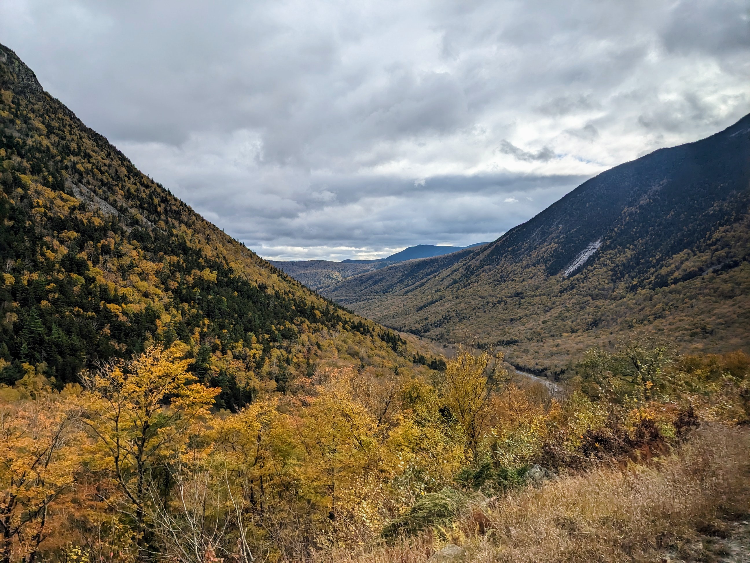
We rode through Crawford Notch to Bretton Woods and back in a luxurious first class coach, enjoying the spectacular views along the way.
The view through Crawford Notch

We also stopped long enough at Crawford Station to take a short walk around Saco Lake.
Our train at Crawford Station
The view towards our train across Saco Lake

It was a truly special train journey, and we were very glad that we had the opportunity to do it