The snowmobile trail up Coburn Mountain is included in the new edition of the Maine Mountain Guide, and I had not hiked that route up yet, so it gave me a good excuse to go back to Coburn. The road to the trailhead is in excellent condition, and I arrived around 8:45.
 |
The trailhead
|
I had heard that a storm earlier in the year caused significant damage to the lower portion of the trail, so I was interested to see how bad it was. It turns out it was pretty bad! Water had carved a canyon up to 6 feet deep in the trail.
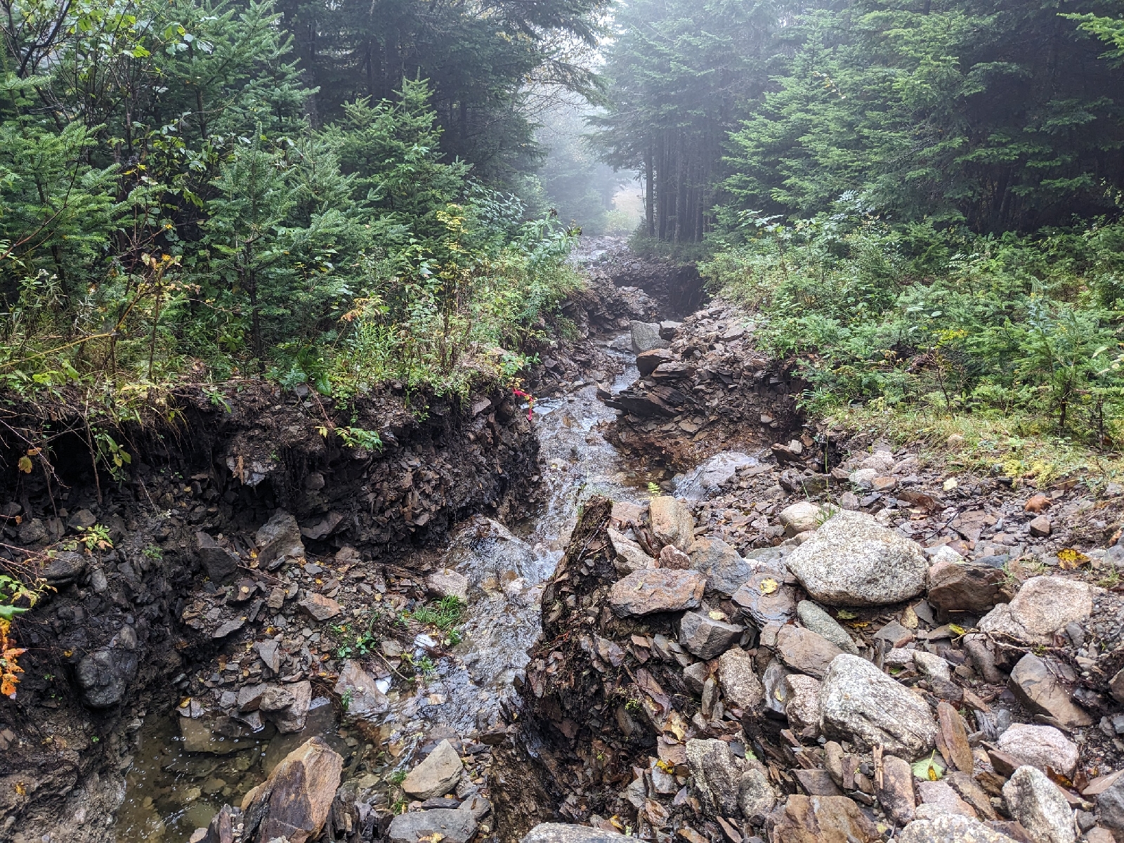 |
An extremely eroded section of trail
|
This portion was somewhat tricky to navigate, due to the loose rocks and dirt, but luckily it didn't last for too long.
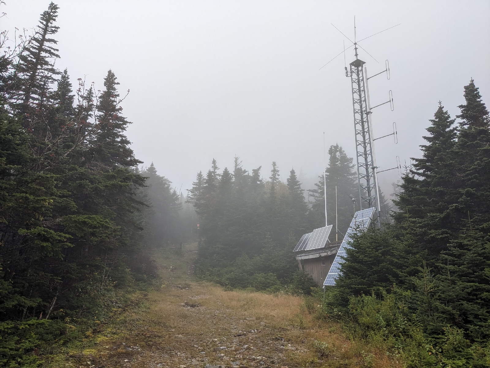 |
The first radio repeater
|
Just past the first radio repeater, I turned right off of the snowmobile trail onto the footpath to the summit.
 |
The start of the footpath to the summit
|
The footpath seems to have seen some significant maintenance since I was there last. It now follows a well cleared trail corridor and both end points on the snowmobile trail are clear and obvious. It is still just about as steep as a trail can possibly be without being a scramble, and it luckily hasn't seen much of any erosion. The steepness of the trail is impossible to capture in photos, but I've given my best attempt.
 |
A steep section of the footpath
|
 |
I took this picture looking across the hillside to try and give a sense of how steep the trail is
|
The summit was in a cloud when I reached it, and it unfortunately didn't seem to be going anywhere anytime soon.
 |
The summit observation tower
|
 |
The summit area and second radio repeater from the tower
|
I spent a bit of time exploring around the summit, and walked a short distance down the old fire watchman's trail heading north of the summit.
 This was the former fire tower which collapsed in an ice storm in 1938
|
|
|
 |
Telephone cable and an insulator for the fire tower just north of the summit
|
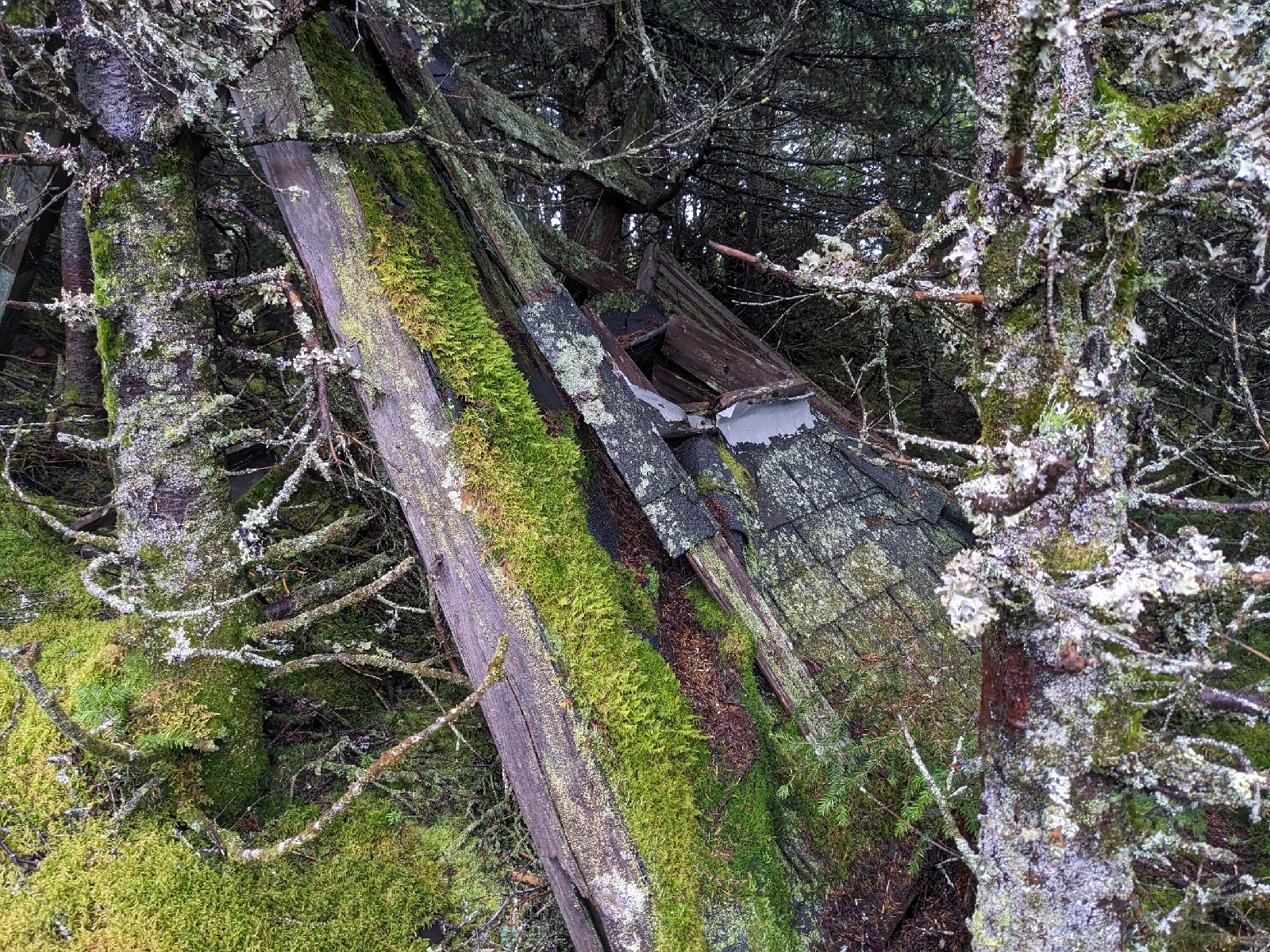 |
Remains of the fire tower cab
|
On the descent, I followed the snowmobile trail.
 |
The upper part of the snowmobile trail
|
The upper part wasn't bad, but the section below the switchback was very grassy and wet.
 |
A very wet section of the snowmobile trail
|
I would definitely recommend avoiding the snowmobile trail in most circumstances and instead just doing an out and back on the footpath. After reaching the lower radio repeater again, I headed back to my car along the lower portion of the snowmobile trail/old road.
 |
Heading down the last section of trail
|
On the drive out, I stopped briefly at Markham Pond, near the start of the Enchanted Mountain Road.
 |
Markham Pond
|
Although I didn't get any of the outstanding views from the top today, it just gives me another reason to head back to Coburn again in the future!


